Trail 29: Andrews Bald
Overview
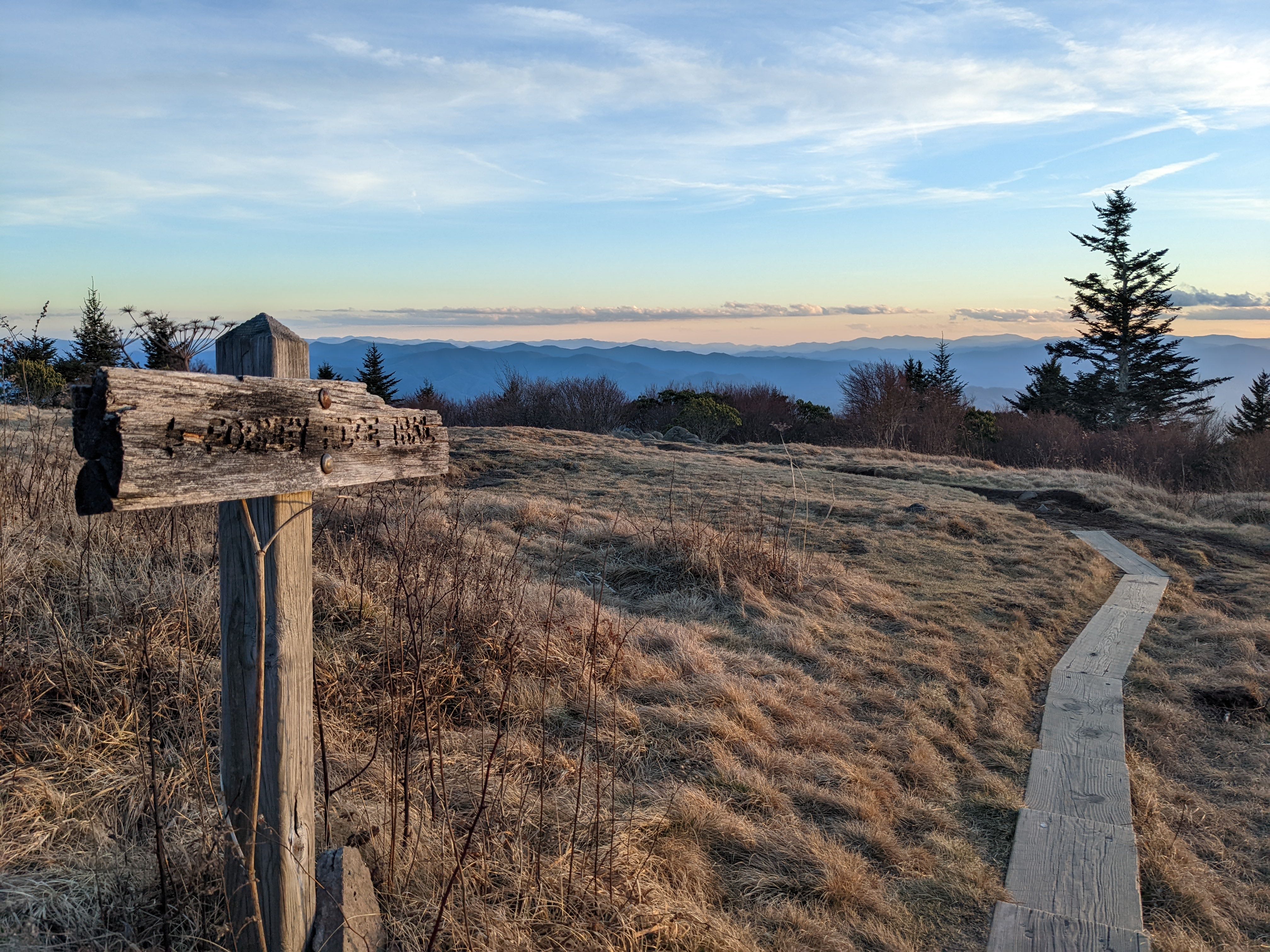
Andrews Bald is the under-rated twin to Kuwohi (formerly known as Clingman’s Dome). Kuwohi is the highest point in the Great Smoky Mountains National Park — the highest point in Tennessee and among the highest in the Eastern United States. Why Andrews Bald instead of Kuwohi? The path to Kuwohi is often exceptionally crowded. It is still worth a visit, but Andrews Bald is as or more exceptional in some ways: instead of reaching a crowded overlook, Andrews Bald is a grassy bald overlooking layers of mountains. Pair it with a trip to Kuwohi or a stop at Newfound Gap, perhaps catching sunset after an afternoon hike to Andrews Bald. One memorable experience for us: we saw a bear on this trail, our first as a family. The hike has some rocky elements, and it can be lengthy, so we recommend this hike for older children.
Key Characteristics
| Characteristic | Details |
|---|---|
| Time Estimate | 2 hours - 3.5 hours |
| Trail Distance (Miles) | 3.6 |
| Elevation Change | Moderate |
| Pets | Not Allowed |
| Parking Pass/Entrance Fee | Required |
| Restroom(s) | Yes (seasonal) |
| Best Ages | Big kids and Pre-teens and older |
| Strollers and Wheelchairs | Not accessible |
Directions to the Trailhead
Trailhead Address: Kuwohi Trailhead, HG43+QG Bryson City, North Carolina
Trailhead GPS Coordinates: 35.55680, -83.49617
The above address is for the trailhead for Kuwohi—formerly named Clingman’s Dome until renamed to its traditional name to the Cherokee, Kuwohi. in 2023. Parking here can be difficult to find during busy periods (especially during the summer, during breaks, and on weekends during the fall).
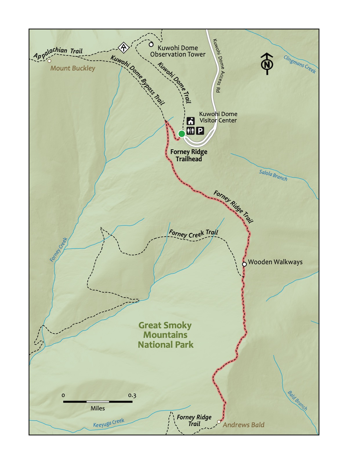
Consider visiting outside of these busy periods to avoid being stuck waiting to find a spot. After finding a spot, walk toward the Kuwohi Visitor Center. Look for the signs for the Forney Ridge Trail (it’s just a few feet to the left along the same path as the Kuwohi Trail).
You’ll feel like you’re in a different state or country when you spot these trees atop the Smokies – usually at elevations above 5,500 feet. Note the “Christmas tree smell”! Afflicted by the Balsam Wooly Adelgid and potentially a changing climate around the ridge of the Smokies, including Kuwohi, you’ll note both dead and diseased and healthy specimens. Recent evidence suggests that the Fraser Firs are healthier as a population than 20-30 years ago.
Trail Description
| Distance from Start | Description |
|---|---|
| 0.01 | Start on the Forney Ridge Trail. |
| 0.2 | Intersection with the Kuwohi Bypass Trail. Turn left. |
| 0.25 | A moderately rocky but well-maintained section that descends. Steep in sections. |
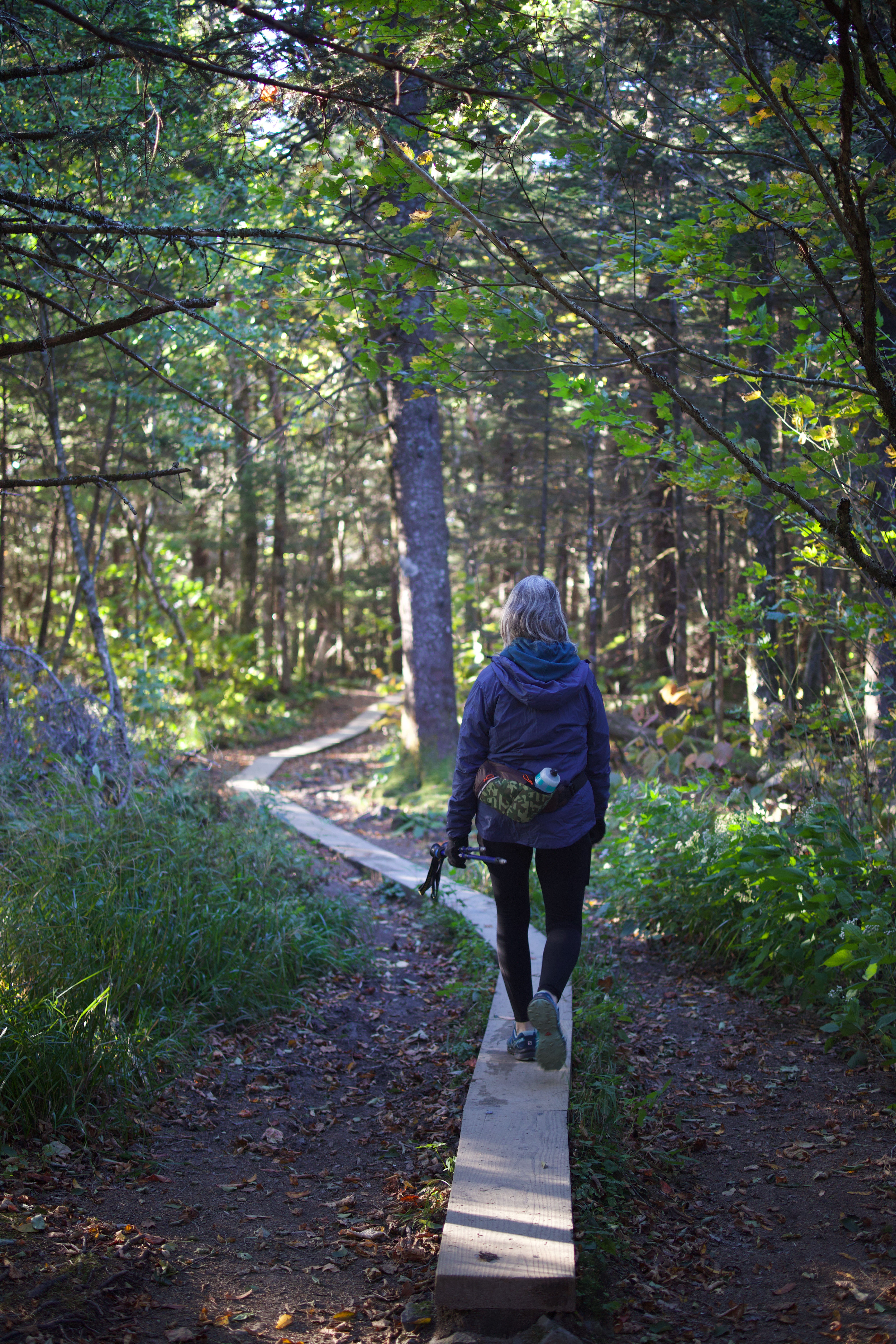
| 1.0 | Wooden walkways over a section that can be muddy. |
| 1.05 | Intersection with the Forney Creek Trail — different from the Forney Ridge Trail. Stay on the Forney Ridge trail to continue to Andrews Bald. |
| 1.8 | Andrews Bald. Explore the super-scenic, grassy area before turning back. |
| 2.55 | Intersection with Forney Creek Trail. Stay on the Forney Ridge Trail. |
| 3.4 | Intersection with the Kuwohi Bypass Trail. Turn right. |
| 3.6 | Trailhead. |
Nearby
- Visiting Kuwohi (Clingman’s Dome). Nearby Kuwohi and the Kuwohi Trail to access this peak feature an observation tower with views in all directions. There’s also the nearby Kuwhohi Visitor Center. Both the trail and visitor center share the same parking area.
- Stopping at Newfound Gap. On the way to Andrews Bald, you passed Newfound Gap—the mountain pass and scenic overlook atop the state line between Tennessee and North Carolina. This is a good place to stop for photos or a brief (or lengthier!) hike on the Appalachian Trail that runs through the parking lot—and toward the popular scenic overlook Charlie’s Bunion, a steep, challenging eight-mile round-trip hike from Newfound Gap.