Trail 18: Angel Falls Overlook
Overview
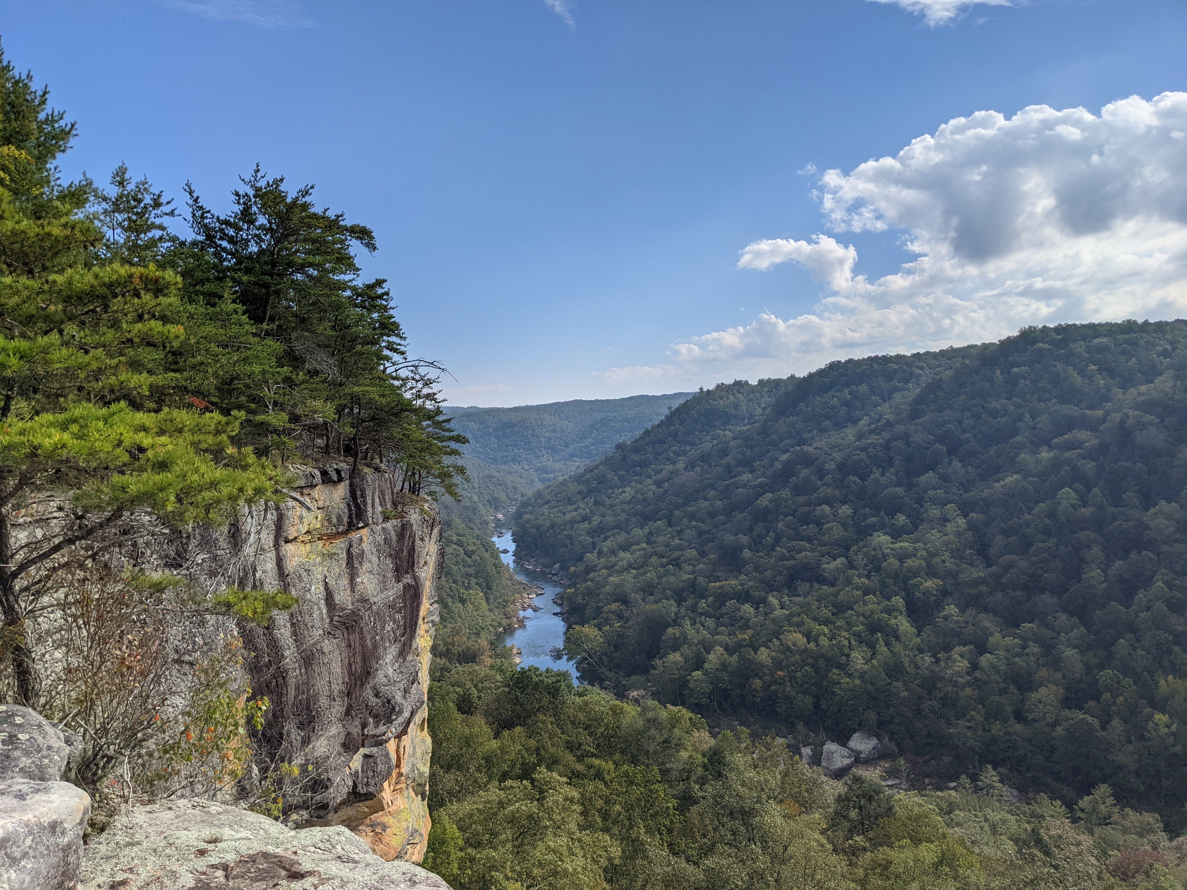
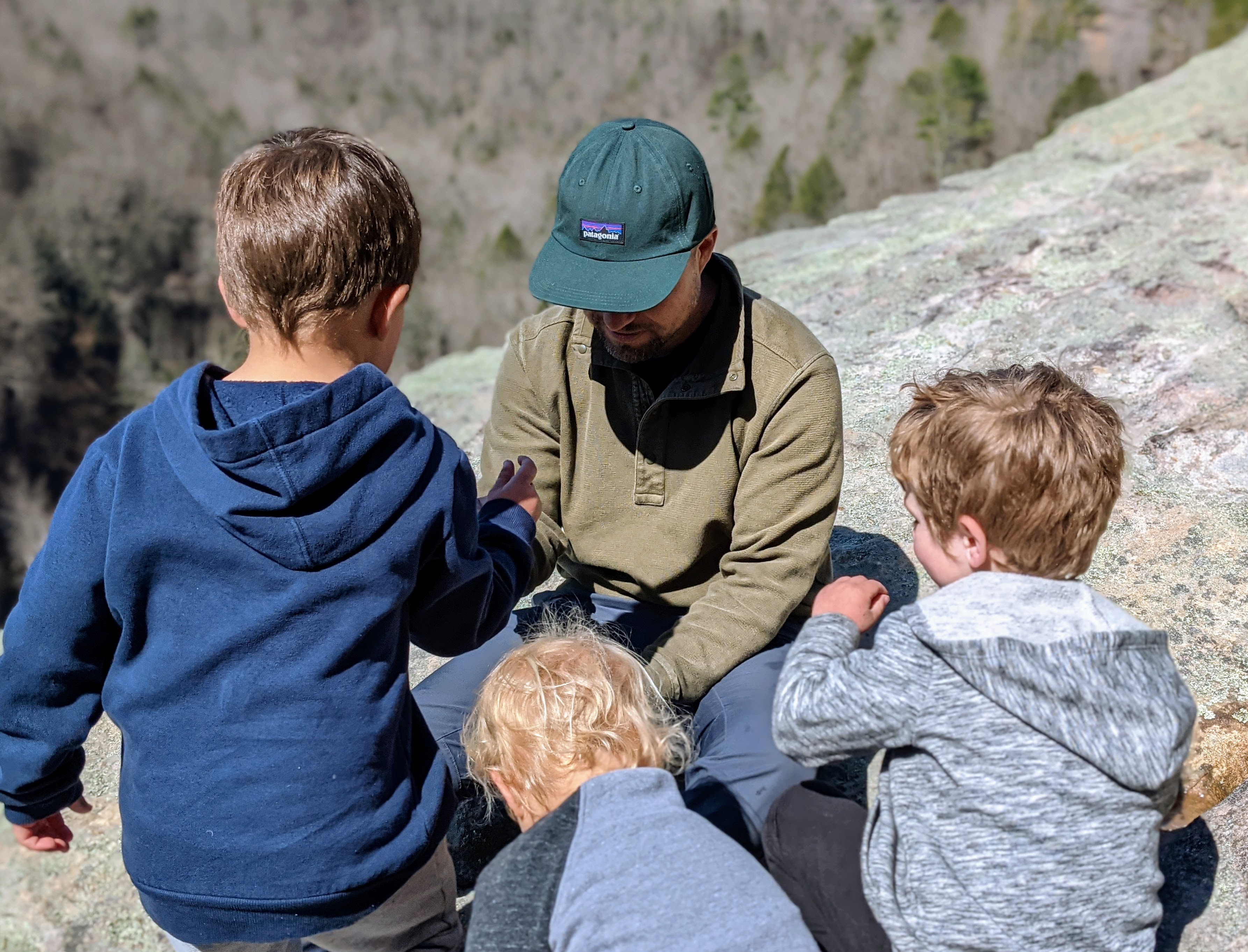
Like a few of the other trails in or near the Cumberland Plateau, this is a spectacular hike that is sadly often overlooked. While this memorable trail is a little tricky to get to for a day hike, the view is awesome, rivaling the summits of the Smokies, with a different kind of vantage of the beautiful Big South Fork River. This trail is relatively flat and short, making it appropriate for families with young children. Consider camping at the nearby Bandy Creek campground, and consider this hike a day’s excursion from there.
Key Characteristics
| Characteristic | Details |
|---|---|
| Time Estimate | 1.5 hours - 2.5 hours |
| Trail Distance (Miles) | 2.8 |
| Elevation Change | Gentle |
| Pets | Allowed on leash |
| Parking Pass/Entrance Fee | Not Required |
| Restroom(s) | No |
| Best Ages | Little Kids and Big Kids |
| Strollers and Wheelchairs | Not Accessible |
Directions to the Trailhead
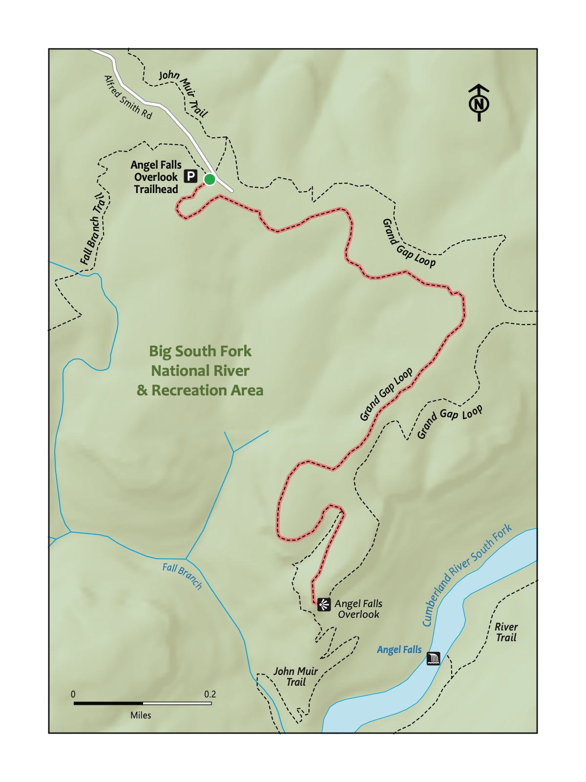
Trailhead Address: Grand Gap Loop Trailhead, G84V+69 Oneida, Tennessee
Trailhead GPS Coordinates: 36.50549, -84.65664
This address is for the trailhead for the Grand Gap Loop, deep into the Big South Fork National River & Recreation Area. The address uses a Google Maps “Plus code,” as there is not a street address for the trailhead. Please note this only works for Google Maps. Turn right into the parking area from Alfred Smith Rd. Look for the Grand Gap Loop Trail to begin the hike.
Angel Falls is more a rapids than a waterfall, but there’s a history to its name: It was a waterfall until the 1940s, when it was dynamited to make the river more easily navigable by paddlers and boaters. It was only a little successful: the rapids are known as being impassable for all but the most intrepid whitewater paddlers.
Trail Description
| Distance from Start | Description |
|---|---|
| 0.0 | Start on the Grand Gap Loop (part of the John Muir Trail - these hikes share a name at this point). Head counterclockwise on the loop trail; the other direction is a much longer way to the overlook. |
| 0.85 | Grave site. |
| 1.0 | Descend gently toward the overlook. |
| 1.4 | Overlook. Rest and picnic at the large rocky overlook atop the Big South Fork and Angel Falls. Then, turn around to return to the start. |
| 2.8 | Trailhead. |
Nearby
- Stop by Bandy Creek. Check out the Bandy Creek chapter for more details.
- Hike the Angel Falls Trail—and others. The Angel Falls Trail—not to be mistaken with the trail taken to the overlook featured in this hike—starts at the parking area beside the Leatherwood Ford Bridge. It follows the Big South Fork River to conclude with a close-up view of Angel Falls, but without the vista from the overlook. Also, the Big South Fork National River and Recreation Area has more than 300 miles of trails.